
Our surveying crews are equipped with the latest Trimble Data Collection Systems including Trimble R10 GPS bundles, S6 and S8 Trimble Robotic Total Stations, and rotary and fixed wing UAVs. All of our party chiefs are well versed in setup and operation of both Conventional and GPS equipment.
Surveyors at Wood Rodgers have a strong understanding of the importance of working cooperatively with contractors, public agencies, and engineers to help create and build a successful project. Wood Rodgers provides independent and internal surveying and mapping support services.

Identify and accurately define difficult terrain features using equipment appropriate for the site conditions. Our work products are produced in 3-dimensional surface terrain maps ready for incorporation into the latest design and analysis platforms including AutoCAD 3D, GIS ArcMap, and a full suite of numerical modeling applications.
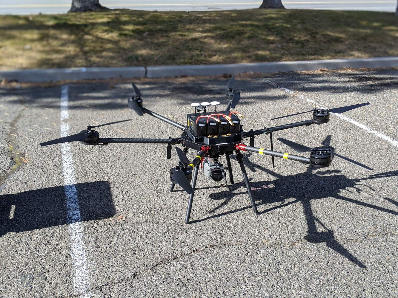
Deploying both fixed wing and multi-rotor aircraft for site reconnaissance, aerial photography, photogrammetry, LiDAR, and topographic surveying and mapping. The ability of an unmanned system to capture aerial imagery and 3D spatial data provides accurate, safe, and economical information in support of engineering analysis and design. In addition, we utilize crewed, fixed wing aircraft with large format sensors for wide area mapping applications.
Topographic and boundary mapping, American Land Title Association (ALTA) survey, plats, Records of Survey, parcel maps, final maps, lot line adjustments, condominium maps, and annexation maps.
Provide aerial remote sensing and deploying other ground-based sensors and services, including mobile LiDAR for transportation / roadway type projects and terrestrial laser scanning for building infrastructure and BIM modelling
Construction staking, quality-assurance surveys, control point establishment, quantities calculations for progress payments.

This aerial mapping project at a major Nevada mining site entailed comprehensive topographic mapping and imagery services. Employing state-of-the-art aerial surveying techniques, we meticulously captured detailed data of the mine's terrain and surroundings with a large format digital camera. The topographic maps furnished precise elevation information, empowering the client to optimize their land use planning and infrastructure development efforts. Concurrently, our imagery services delivered comprehensive visual documentation, offering a holistic perspective of the operational landscape. In support of the aerial mapping, we established a robust static survey control network and aerial flight targets. This data allows stakeholders to move between a historic local mine coordinates and known UTM coordinate projection. This project exemplified our dedication to leveraging advanced technology and expertise to provide tailored geospatial solutions, ultimately facilitating informed decision-making processes for our clients within the mining industry.


Wood Rodgers' survey team performed terrestrial laser scanning at this mine's processing plant, which has proven to be instrumental in advancing engineering efforts to upgrade and optimize the facility. By harnessing the detailed and precise three-dimensional data acquired through laser scanning technology, the point cloud and BIM models provided engineers with valuable insights into the plant's current layout, identifying opportunities for improvement and areas requiring upgrades. This comprehensive dataset aids in the development of innovative solutions to enhance processing efficiency, streamline workflow, and address any structural or equipment concerns. Leveraging the information derived from the terrestrial laser scanning, our client can make informed decisions, ensuring that upgrades are strategically implemented to maximize operational performance, minimize downtime, and ultimately contribute to the sustainable and successful re-start of the gold mining operation.

The largest surveying contract in the Reno office, Wood Rodgers was retained to provide numerous surveying activities for this on-call contract. For over 30 months Wood Rodgers had a survey crew permanently based at the site supporting ongoing construction. These activities include as-built surveys on excavation and finished grade pads. Construction layout and QA surveys on slabs and footings for buildings, crushers, and conveyors. Regularly scheduled and as requested volume surveys performed with both ground and aerial survey methods. Quarterly aerial surveys for environmental monitoring and disturbance reports


